Draft Dereel Map

draft-dereel-map-for-comments

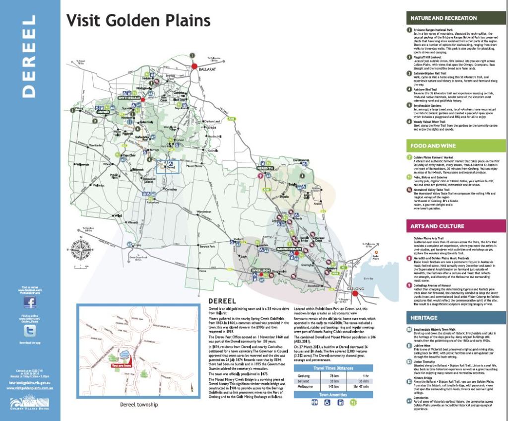
Community planning projects are continuing to bear fruit. Pam Bailey has been working with Mick Cosgriff from Golden Plains Shire to update the Golden Plains Shire map of Dereel.  The image below shows the general look and feel of the map, and the headings standard for Golden Plains Shire maps.

Pam is also working on a second Dereel map with local graphic designer Andrew Willox which shows the street layout of Dereel. Andrew has drawn the map which will be displayed in the vicinity of the Dereel Soldier’s Memorial Hall and Community Centre.

If you would like to provide suggestions for either map, including ideas for the points of interest shown, please let Pam know via the dereelspokes@gmail.com email address.  Alternatively, please make comments below.  You are also welcome to attend the next Community Planning meeting at 7:30pm on Monday 16th April in the Dereel Community Centre kitchen.

draft-dereel-map-for-comments
A draft of the new Dereel map. Do you have suggestions for points of interest?

2 responses to “Draft Dereel Map”

  1. Douglas Raymond Charles Braddy Avatar
    Douglas Raymond Charles Braddy

    Avery good project. Maybe a list of local businesses and or services would be a great inclusion,also all the local groups as information for people visiting or planning to move here ..

    Liked by 1 person

    1. Thanks Doug. Stay tuned for a list of local businesses. We are planning to develop that as a page on Dereel Spokes.

      Like

Leave a Reply

Fill in your details below or click an icon to log in:

WordPress.com Logo

You are commenting using your WordPress.com account. Log Out /  Change )

Facebook photo

You are commenting using your Facebook account. Log Out /  Change )

Connecting to %s

This site uses Akismet to reduce spam. Learn how your comment data is processed.

Create a website or blog at WordPress.com

%d bloggers like this: